So with the trip out of the way and the benefit of hindsight what did I learn that I can use for future trips? An easy place to start is with my gear.
I really need to get a lightweight quilt for summer camping. My nights will be much more comfortable and if I’m better rested then my days on the bike will go much better too. The thing doesn’t need to be too warm but it should be small.
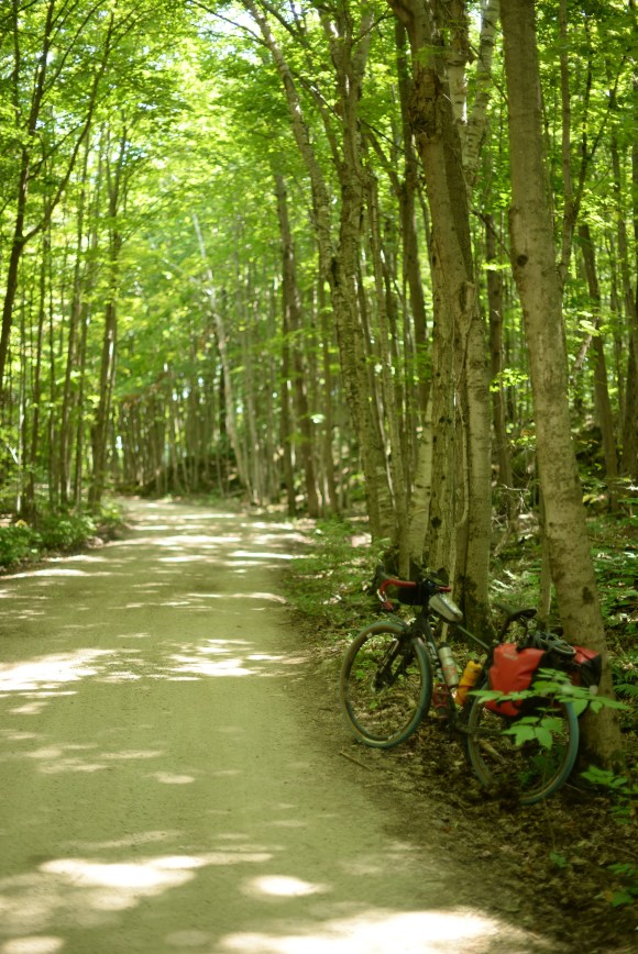
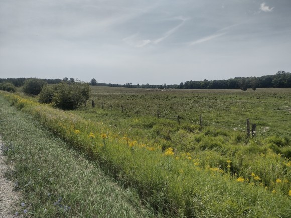
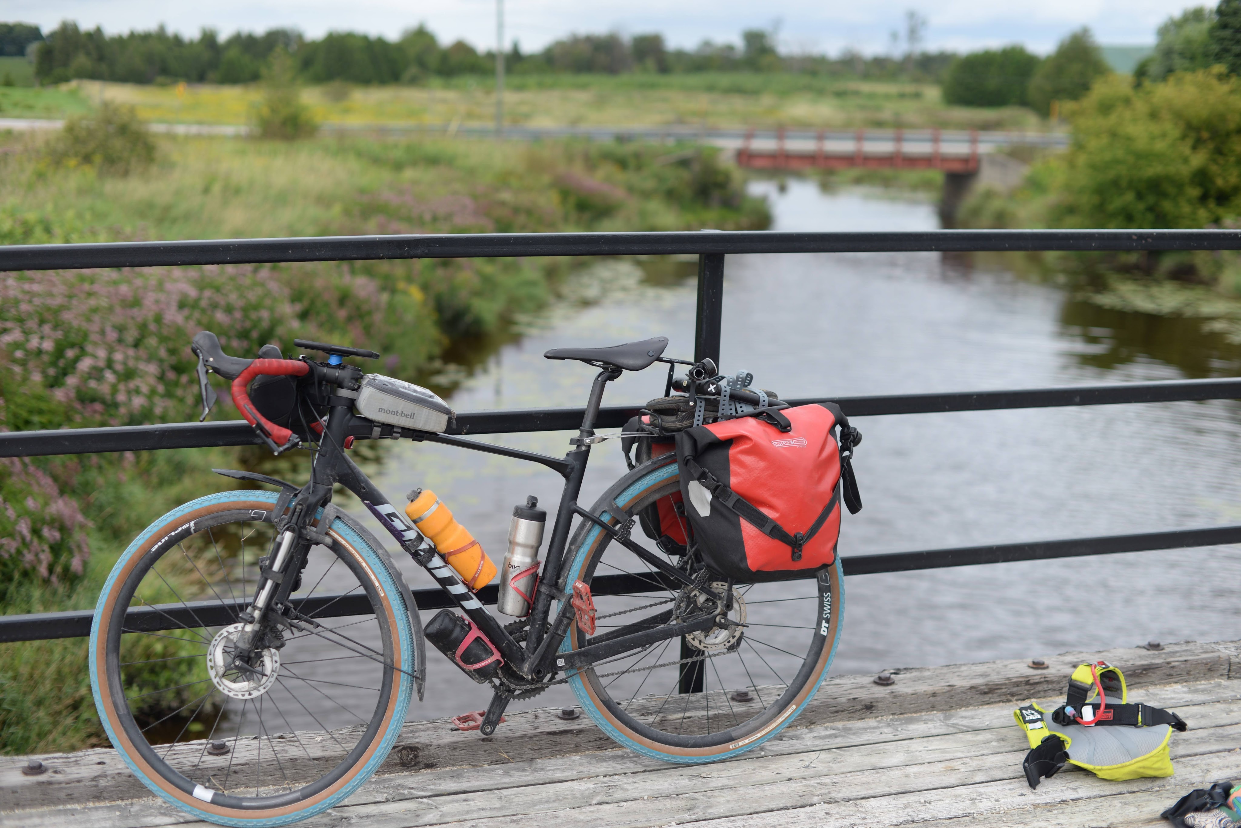
My commuting setup that I’ve used everyday for thousands of kilometres had no problem handling a week of long days on gravel roads, ATV trails, and singletrack. That being said there are some changes I’d make in the future. First off I’d want to get my tent and any sleeping bag out of the panniers and onto my front fork. My panniers have enough space to hold them but they get in the way because they’re pretty big. By getting them out of the way I’d be able to access my other things in the panniers more easily and wouldn’t have to fill them up as much. Sometimes I feel like I want to get rid of the panniers and put a trunk bag on my rack instead. The advantage of a trunk bag over a large seat pack is that it won’t bounce around and will be easier to open and close. If I didn’t have the rack then I’d be stuck with the seat pack but as it’s there I may as well make use of it. The only thing is with the panniers I can still strap stuff like my sandals and lock directly onto the top of the rack. With a trunk bag the real estate is gone on the top so I’d probably end up strapping them to the sides of the rack.
The hydration pack was great for keeping me hydrated and storing things but it wasn’t great for holding my camera because I’d have to take the pack off in order to open it to get to the camera. Stopping to take a picture is one thing, having to take my backpack off as well probably prevented me from taking more pictures on the way because it would be too much of a hassle. I think if I get a bigger handlebar bag then I can put the camera there instead as long as I’m able to easily open it from the top.
Apart from gear, what lessons have I learned from the trip in general?
For one thing pacing matters. My days were fairly long, I could have gone farther on my second day but otherwise I didn’t have much time at camp at the end of the day which was fine because sitting around camp by myself doesn’t really sound that fun. If I was going with other people I’d probably shorten the days because hanging out at camp is more enjoyable then.
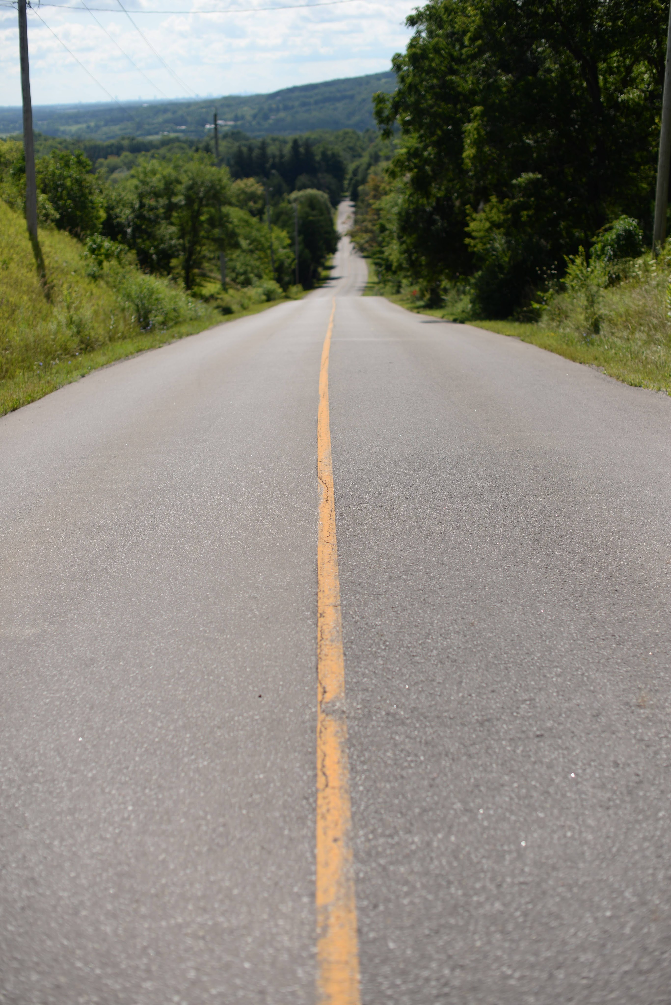
Route choice matters too. When I was just picking points on the map and letting apps auto-route me the rides were fine but it was definitely more interesting riding along the GNBR. I think wherever possible it’s a better idea to use actual routes. It’ll add distance but it’ll also add variety. When I rode part of the No Winter Maintenance route 2 winters ago it had us on closed roads and ATV trails for sections, and even though some of them were in bad enough condition to be unrideable in part it was still a fun ride. More than if we had just been riding on small roads or gravel roads for sure.
Cooking really is optional. There were always opportunities to pick up food along the way and if I knew there was going to be a long period before being able to resupply, like on my way back from Tobermory, I could just buy some extra food to eat later on. As long as I have some granola bars and other snacks then I’m even good for riding a couple of hours before getting a proper breakfast, although that isn’t ideal. If I was going with others I’d probably bring the stove and kettle so that I could make hot chocolate or coffee around camp but otherwise there’s no need to do any cooking if the route is passing through communities.
The more you know about how to fix your bike on the road the better. I’ve heard that a tubeless tire that is repaired with a plug is pretty much good as new and the repair will last as long as the rest of the tire. Of course when the time came for me to actually plug my tire I wasn’t able to do so and I had to use my backup option of putting a tube in and replacing the tire. Probably the tire would have lasted until I got home but that wasn’t something I wanted to risk.
Related to this is if you don’t have confidence in your setup then you’re going to have doubts in the back of your head, so really try out as much as you can ahead of time so those doubts are gone. Putting on extra clothes at night and wondering if I’d be warm enough was not a good way to try to sleep at night. Similarly once my tire was punctured, even though my emergency repair would have probably lasted I’d lost faith in the tire and would be worrying about it the whole time. Better to just get it replaced instead of worrying and risking an unrepairable tire in the middle of nowhere.
I want to plan another trip this summer to put all these lessons to the test and learn some new ones but the only possibility would be doing a family trip in August, maybe a 4-day trip around a weeken, and I have pretty large doubts about my ability to convince everyone into doing that.
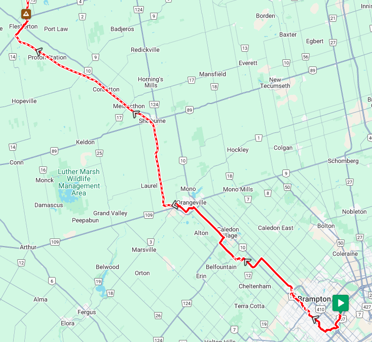
The final stretch! Today’s going to be a reasonably long day but relatively easy at the same time because I can arrive in Barrie up to midnight and still be able to get home. Because of this I’m splitting my ride in 2: I’ll ride down to Wasaga Beach and then hang out there for a couple of hours before finishing the trip to Barrie. The forecast does call for rain so let’s hope the weather cooperates!
My route has me riding down to a gravel road and taking that to Meaford but looking at Google Maps I see that I can continue down the road the campgrounds is on and there’s a Tom Thompson Trail that will connect it to another road that’ll take me to Georgian Bay and a Lakeshore Road that’ll take me into Meaford. Seems more scenic and I’ve got time so off-the map it is. The trail is well signed and not too rough but there is one section where it goes down and up to cross a stream which is too steep for me to bike so I have to hike-a-bike that part but it’s just for a couple of minutes. The trail for the rest of the way is fine and the road it connects to is nice and quiet. When I get to Lakeshore Road I see that the road goes a bit farther and there looks like a path to a beach so I make a slight detour to check it out. There’s a nice view of Georgian Bay and whoever lives nearby is pretty lucky.
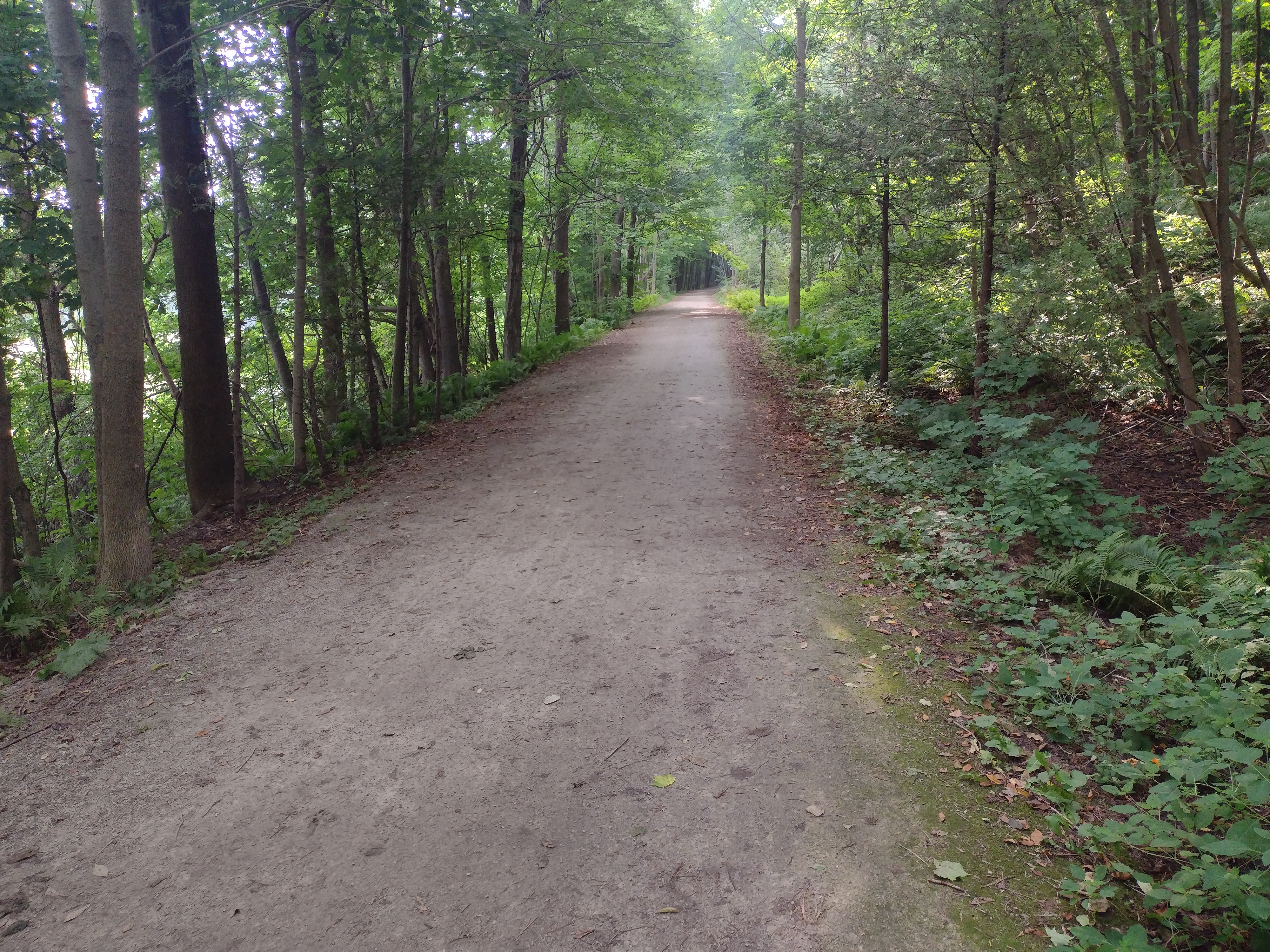
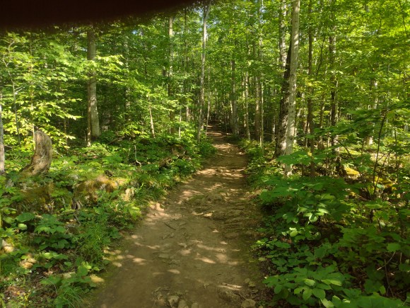
After taking in the view I go back to Lakeshore Road and continue riding. It looks like the municipality is in the process of repaving the road so I need to detour a couple of times but it’s still an easy ride into Meaford. I start on the Georgian Trail and then decide that I may as well have breakfast now. I go for the easy breakfast option of Tim Horton’s, no fancy coffee and pastry today, and then head back to the trail. The Georgian Trail is nicer than the other rail trails, it’s mostly forested and there are nice features like wooden bridges along the way.
The Georgian Trail ends in Collingwood. I’ve only ever driven through it heading up to Blue Mountain but it seems like a nice town. My route has me continuing on a rail trail and then taking small roads to get to Wasaga but I decide that I want to stay closer to the water so go off-route once again.
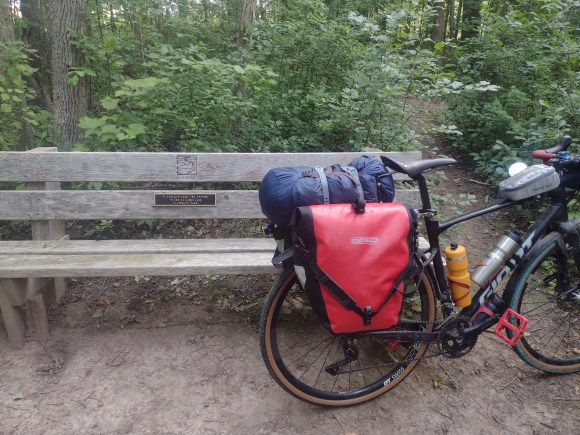
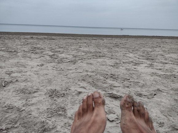
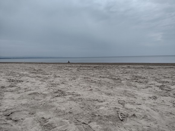
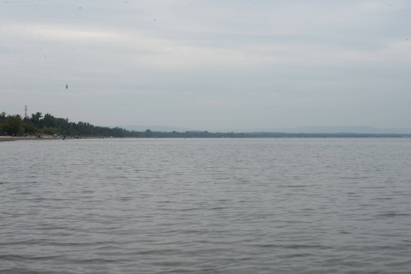
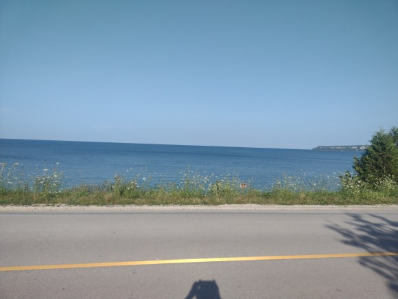
This time it isn’t such a good choice because the roads near the water aren’t continuous and keep looping back onto the main road which has a lot of traffic. It isn’t terrible but not a calm ride on a trail or empty gravel road either. Finally though I get close to Wasaga Beach and the small roads near the water do become continuous and I don’t have to loop back and forth. There are a lot of stop signs but I’m not going fast so it’s fine. I decide on Mexican food for lunch and have a huge burrito and then ride to the grocery store, a Superstore this time not a Foodland, to get some junk food, and then head to the beach. It’s cloudy and still looks like it’s going to rain but it’s also warm so sitting on the beach is pleasant. The relatively poor weather maybe means that it isn’t as crowded as it would be otherwise, there are still people but everyone has a lot of space around them. Still in planning mode I decide I’ll stay at the beach and watch Manchester United’s first game of the year but before that I’ll go for a swim so that I can watch and dry off at the same time. The water always feels cold at the start and it stays shallow for a long time so I have to will myself to jump in and fully submerge myself in the barely waist-high water. I’m not particularly tired or sweaty but it still feels so good to swim in the water. It’s cloudy but I can see what looks like a grain elevator in the distance, is that Collingwood or some other town? I couldn’t tell you. Manchester wins the game 1-0 but it was a pretty poor game and the goal comes late. A win’s a win though. Once the game’s over it’s time to head out.
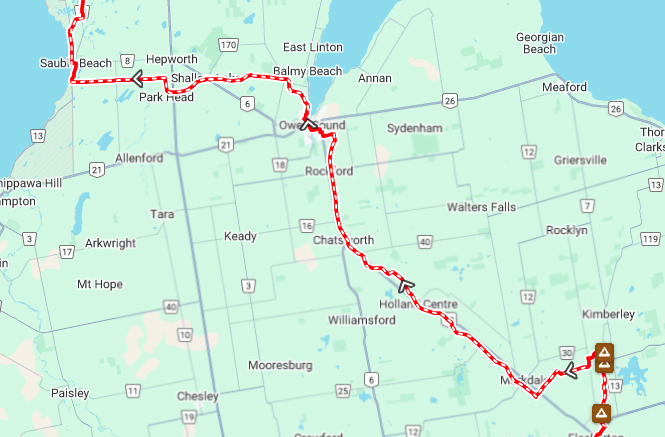
The plan is to ride towards Elmvale and connect to the North Simcoe Rail Trail. For the most part the rail trail is pretty boring, fairly flat, featureless terrain passing through farmers’ fields but there are some sections where it goes through forest which are quite nice. On the whole there seems to be a downward slope to it so I’ve got elevation on my side. At some point my trail joins up with a mountain bike park and I see other people riding various side trails while I’m trying to make sure that I’m staying on the right one. I lose my bearings but eventually end up back on the trail. Eventually my time on the rail trail comes to an end, the trail continues but it starts to curve away from Barrie so I need to go back to normal roads. This coincides with elevation no longer being on my side and I need to start climbing some hills but nothing like what I had to deal with on day 2. Even here all the elevation I gain with my climbing means that I finish with a really big downhill as I approach Hwy 400 in Barrie. I really wouldn’t want to climb up this hill so here’s a tip, if you’re planning on riding the rail trail from Barrie out to Midland or Wasaga try to adjust your route so that you can avoid Leacock Drive, although for all I know maybe there is no avoiding that hill.
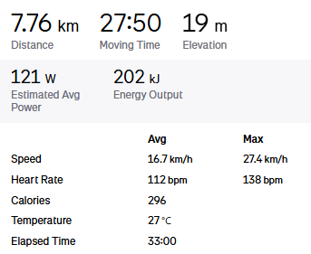
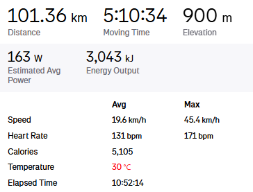
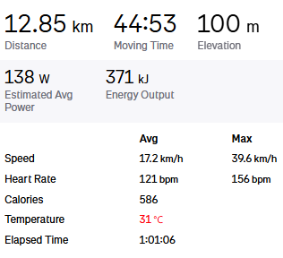
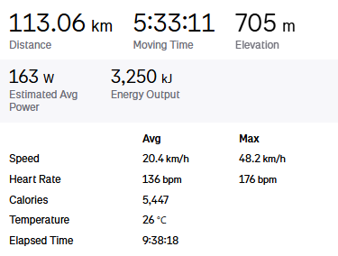
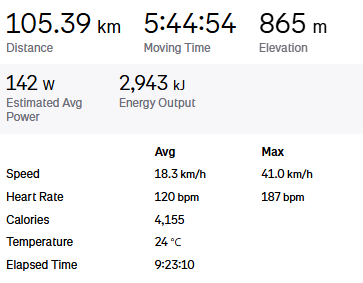
I’m back in Barrie and I have time to kill so I may as well have supper so I’m not dying of hunger on the train back to Toronto. I Google what’s available and decide on a Thai restaurant. Thankfully they have a pretty large, empty patio section so I can eat out there without disturbing anyone else because I probably don’t smell that great. Also this way I can keep my bike in my line of sight. I’m hungry and there are lots of tasty looking dishes on the menu so I order more than I should and have to fight to finish it all but I’m able to do it. Why not, I burned 5,300 calories today according to my watch so I can eat as much as I want. After I finally finish I ride back to the station to wait for the train to arrive. It’s definitely cooler now but I don’t feel like digging out my baselayer or jacket to put on so I just live with it. The train ride back to Downsview station is pretty boring, I’m back to just looking at my phone, but my day isn’t done yet, I still need to ride back home from the station. It’s only about 3.5 km from the station to the hydro corridor and then an easy straight shot home and before I know it I’m back home.
One advantage of doing a bikepacking trip over a hiking one is that you don’t need to be as self-sufficient because depending on your route you may be passing by multiple towns or at least points to get some water and food. That being said it’s always a good idea to have supplies on hand because life in unpredictable and shops and restaurants might be closed, your route or schedule might change, or there could be some other issue that might mean you won’t be able to replenish supplies as planned. In my case because the Foodland was closed by the time I got to Lion’s Head it meant that I’d be eating granola bars and water until I came by an open store. My first chance would be in Hope Bay about 25km away. According to Google Maps there’s a general store there so with any luck I’d be able to pick up a muffin or cookies and something to drink.
When I get out of my tent I can barely see anything because the whole area is covered in a dense fog so it was probably a good idea to do without that emergency blanket. It isn’t too cold and once I start riding I warm up quickly. Riding early in the morning on quiet roads is nice because the world is silent and I don’t need to worry about cars, not that there’s a lot of car traffic out here anyway. I make it to Hope Bay, which is another pictaresque bay, and see the general store but it isn’t open. It looks like it’s the store for a resort/campground and while the sign on the door says it should be open it looks like whoever is supposed to be running it is doing something else. I wait around on the beach for a while hoping someone will show up and have another granola bar. It looks like I’m not going to be able to get anything until I make it to Wiarton another 35km away.
The ride to Wiarton is pretty nice. I start along Hope Bay Road, hugging the shore and passing by houses. The road dead ends with a gate that says “road closed” but that just means that there’s a rougher gravel road on the other side of the gate. A car would need to do something about that gate but a biker or walker can just go under it which is what I did. The road just goes through a forested area, there aren’t any houses or other streets so it’s pretty desolate although there were a few people walking along it, maybe they were camping somewhere nearby. Eventually I start to see campsites so I guess I’m in some campground or park. It turns out this is Cape Croker Park which looks like a nice campground to stay at if you’re going to the Bruce Peninsula. One for the future. After that it’s more gravel roads until I get back to Highway 6 for the descent into Wiarton.
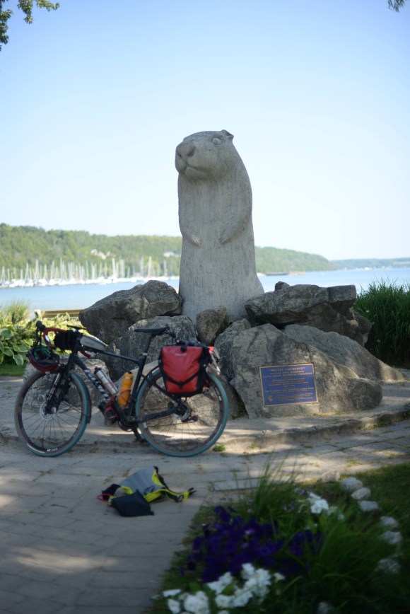
Wiarton is a proper town and by this time everything is open. I stop at a coffee shop and get a coffee and chocolate croissant. At one level I can appreciate that both the coffee and croissant are better quality than the coffee and chocolate eclair I had at the Markdate Tim Horton’s but on another level that quality is wasted on me in my present state and I just want the carbs and caffeine. I still take my time with it because I’m ahead of schedule thanks to not stopping off for breakfast earlier. Because I’m in Wiarton I have to visit the statue of Willie and after that I go to Foodland to stock up. When I finish my shopping some other cyclists stop to pick up something, one of them goes in to shop and the other watches over the bikes. They’re roadies on expensive looking bikes. One of them warns me about the main roads, especially Highway 26 as there are a lot of trucks on it. I told them that I’m mostly riding on smaller gravel roads but thanked them for the advice and went on my way. Sure enough I leave Wiarton and am back on quiet gravel roads. At some point my route merges onto the Bruce Trail and I’m riding on singletrack for a short section! It was fun but on a gravel bike with loaded panniers it was pretty rough so I’m glad it was just for a short section.
As I’m riding I’m noticing that my rear tire is getting squishy pretty quickly and I’m having to stop to pump it up every half an hour. I see that there’s a puncture and try to clean the area to give the sealant a better chance of plugging the hole. I ride some more and am losing pressure again so I add some additional sealant in case I’ve used it all up over the course of the trip. It still isn’t helping so finally I have to stop and try to plug the hole. I have the reamer and plugs and know what I’m supposed to do but this will be my first time actually doing it. It doesn’t go well. I can’t push the reamer into the existing puncture and if I can’t do that then the plug won’t go in. After spending too much time trying to plug the tire I decide to give up on that and go to plan B: patch the tire with a tire boot and put in an inner tube. It takes a bit of doing to do this because taking off and remounting tubeless tires is a hassle but eventually I’m able to do it and am ready to continue to Owen Sound where hopefully there will be a bike shop I can get my tire replaced at. Chances are I’d be fine for today and tomorrow on this tire and tube but I’d rather not leave that to chance if it could be helped.
The ride in to Owen Sound was fine and I’m able to find a bike shop. I explain the situation and they have a tire that’ll work and can install it for me. While they’re doing that I go out to look for food because there isn’t anything between Owen Sound and the campground I’ll be staying at. I end up getting a pizza and come back to the bike shop. They say the bearings in one of my pedals arein bad shape and ask if I want to switch out the pedals. I’d noticed that the pedaling was rough but thought it was the bottom bracket. As I’m already at the bike shop I figure I may as well do the pedals too. They also say that my front brake pads were pretty worn down but they don’t have any in stock so I should check in Collingwood tomorrow. Repairs done I was ready to leave Owen Sound but all my roadside repairs plus the detour at the bike shop means that I’m behind schedule. I decide to take a more direct route to the campsite, but keeping in mind the advice I received in Wiarton I decide to go on Highway 18 instead of Highway 26.
Highway 18 is still a pretty busy road. Thankfully it has wide, paved shoulders which I can ride on but there are a lot of cars and trucks driving by. Nothing can be done about it but between the road, lateness in the day, and the troubles I’ve had up to now this was by far the worst stretch of the trip so far. I’m able to make it to the campgrounds while it’s still bright out. They’ve got a solar heated pool and I decide I need a swim after a long day in the sun. The pool actually isn’t very warm but I stay in it until it starts getting dark and then take a nice hot shower afterwards. They have laundry machines here so I decide to clean my clothes. Even though I’ve only got one day left I figure anyone near me on the train ride back home tomorrow will appreciate it.
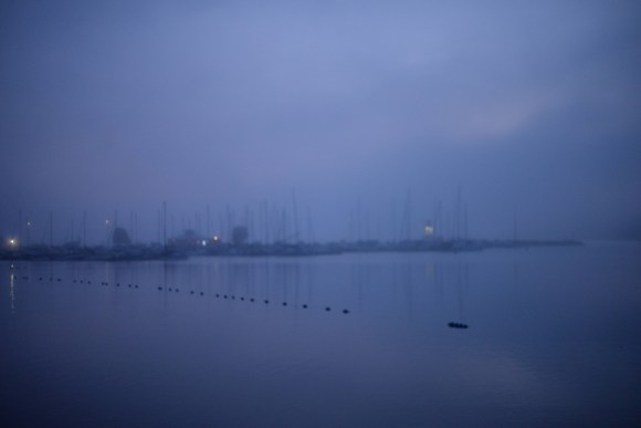
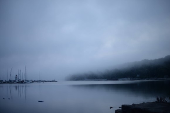
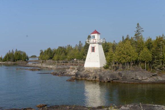
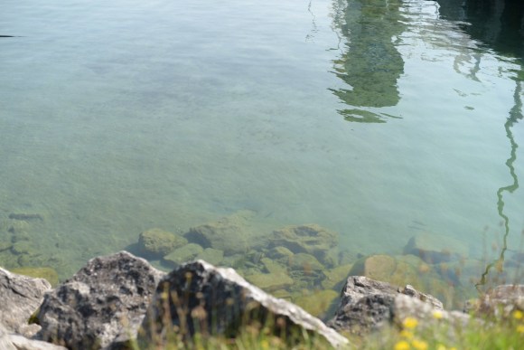
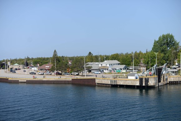
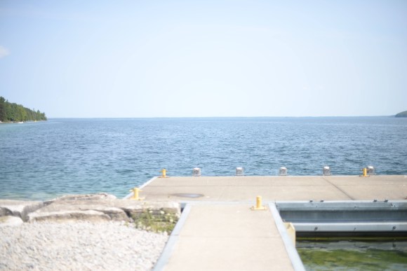
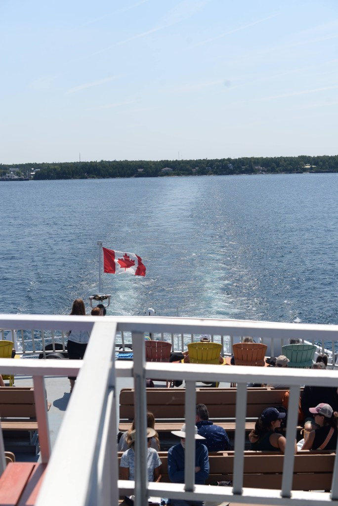
Rest day over I’m officially past the half-way mark so it’s time to start the journey home. Leaving Manitoulin Island means taking the ferry back to Tobermory and the first ferry of the day leaves at 11:10am so there’s no need for an early start. Even still, once I’m up there isn’t much to do at camp so I figure I may as well go down to South Baymouth, get some breakfast, buy my ticket, and hang out there until the ferry comes in. South Baymouth is tiny, you could walk the whole area in 5 minutes, but it has a couple of Pokemon Go gyms for me to take over and a picturesque little lighthouse. After that I just spend my time looking at the water waiting for the ferry to come in, it is very clean!
One thing about being on a bike waiting for the ferry is that you stick out a fair bit. Pedestrians are able to book passage on the ferry neither the Bruce Peninsula or Manitoulin Island have much in the way of public transportation so all the other passengers had their cars with them. So there were curious people asking where I was going and where I had been. For whatever reason a lot of these were Americans. I’m not sure if Manitoulin Island has more American tourists than anywhere else in Ontario. It could be there are lots of American tourists in Toronto or any of the other places I visited on my trip but because I didn’t talk with them I didn’t know they were American. It could also be that American tourists are just more outgoing so they were the ones to start conversations with me. I had fairly long conversations with a couple of Americans both waiting for the ferry and on the ferry itself. Once you’re out of sight of land you’re just surrounded by endless water, which is nice for a bit but gets boring, so you may as well talk.
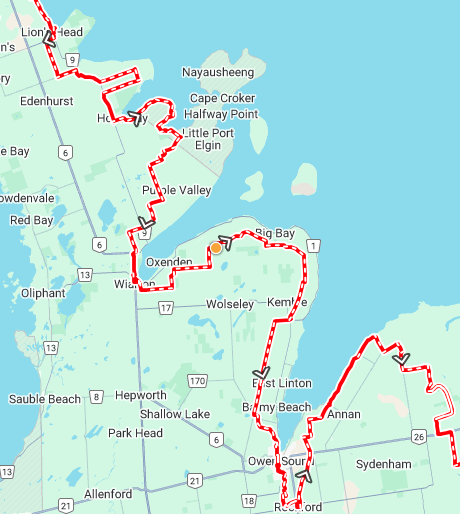
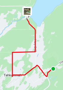
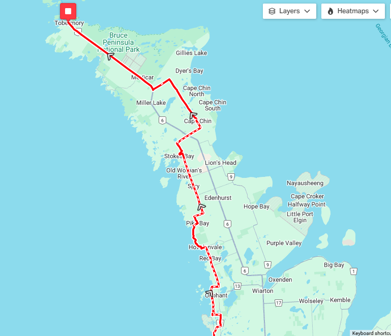
Leaving Manitoulin at 11 means that I arrive in Tobermory around 1pm, half the day’s already done! I stop at the Foodland to pick up some sports drink, granola bars, and cookies. Also they had foil emergency blankets so I get one of those – maybe I’ll be able to sleep warmer at night. My goal today is to make it to Lion’s Head, which isn’t too far from Tobermory but the route I’ll be taking meanders. On the way up I made my own route using navigation apps and it was pretty much the shortest route that kept me off main roads. On the way down I’m using the Great Northern Bikepacking Route which was developed with contributions from people that live and ride in the area. I’m not sure exactly what to expect but the route has me zigzagging my way down so it looks like it’ll be a fun day.
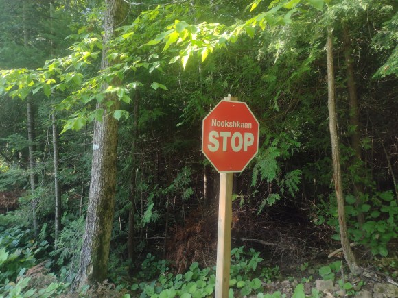
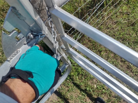
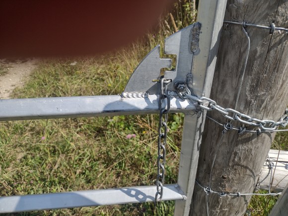
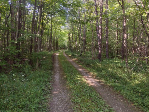
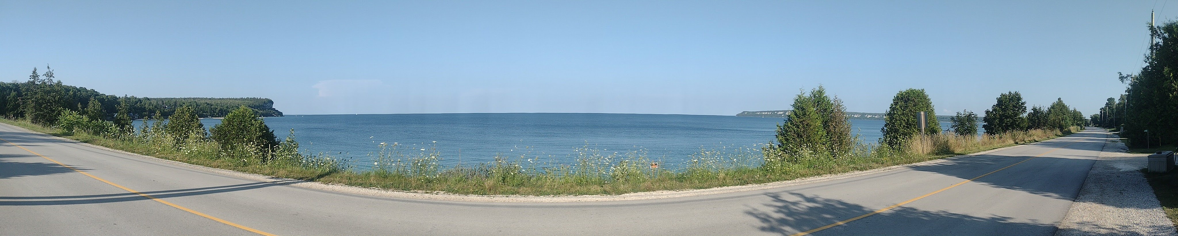
The route immediately takes me away from Highway 6 onto some small deserted road. Nothing here but driveways to cottages. I follow the road to it’s end and there’s supposed to be a hydro cut I can follow to connect me to the next road but for the life of me I can’t find it. I walk around the area ignoring the no trespassing signs and while I can see the hydro wire the terrain underneath it doesn’t seem passible for as much as I can see. I could probably hike it, but pushing my bike along for however long until it gets clear doesn’t seem like the best idea so I decide to backtrack. That means going back to Highway 6 and passing the Foodland to go down to the next road my route would have connected to. Not the most auspicious start to using the GNBR but on the next turnoff it starts to get better. First off I pass by the secret cottage of 2 founding Avengers and soon after there’s a nice lookout onto Lake Huron. The road passes by a campground and after a bit more I’m back to Highway 6, but just to cross onto the other side. The road on the other side has a No Exit sign on it which means adventure is up ahead, the gravel gets a bit rougher and there’s a pretty big downhill that goes on a for a long time and at the end the forest road opens up onto a couple of farmhouses. Past the houses the road is blocked by a gate but an ATV trail continues beyond it so I just need to open it to continue. The gate isn’t locked but it does require me to solve a puzzle in order to continue, I’m figuring its a way to make it so that people can open and close the gate but livestock wouldn’t be able to. I need to move the chain along the slots so that I can remove it and open the gate. I’ve never seen something like this before and while I know what I’m supposed to do it takes me a bit to figure out how to actually move the chain in order to do it. But eventually the gate is opened and I can continue on my way, but first I have to close the gate and put the chain back in.
Just like riding on gravel roads is more fun but slower than riding on paved roads. Riding on ATV trails/doubletrack is more fun but slower than riding on gravel roads. The trail goes from forest to clearing to forest again and because it had rained a couple of days ago in some sections there are puddles, some that I can blast through and some that are really big I have to be a bit more careful crossing so that I don’t totally soak my feet. As I approach and ride through the smaller puddles all these frogs that were hidden in the water jump out in every direction. It’s both creepy and cool and I tell myself that I probably didn’t run any of them over. While I’m riding I spot a small lake and decide that would be a nice place to take a break. Along one side of the lake it looks like there are a bunch of cottages and some people are even swimming by their docks. The lake is really small and from where I am the water looks pretty murky. It probably isn’t that bad but I’d rather swim in a larger, clearer lake.
One problem with riding through forested sections is if I stop then the bugs will be all over me. I didn’t bother packing insect repellant because I figured I’d be moving most of the time and I’d be sweating it out pretty quickly anyway. Even while moving some mosquitoes and black flies will land on me but it’s a lot better than when I have to stop, like when I need to tree pee. As I approach Lion’s Head the forested road opens up and along one side I can see the bay right under me. It’s an abrupt change and while riding on the trails and roads didn’t feel particularly claustrophobic there is definitely a very welcome feeling of openness one this stretch of the road. I make my way into town, the campground is right on the lake by the beach. Kids are playing on the beach and going for a swim would be fun but it’s pretty late in the day and I want to make sure I can get supper before places close for the night. By the time I get there the local Foodland is closed so I won’t be able to get anything for tomorrow’s breakfast from there but at least there are open restaurants for supper today. Back at the campgrounds there are washrooms for campers, you need a combination to open the lock, and I can take a nice long shower and leave my battery for charging for a while. When it’s time for bed I decide against opening up the emergency blanket I bought today as an added layer because I’m worried about condensation, it might get pretty damp right by the water. Hopefully it won’t get too cold tonight.
When I planned the trip I gave myself a rest day on Manitoulin Island because I had to reserve my campsite for 2 nights during the Perseids. I was also unsure how beat I would be after three days of riding and being out all day. This is a vacation so I’m allowed to relax a bit right? So after another cold night I wake up relatively early and no one else is awake. There isn’t really anything to do and it’s still a bit cool out so I just get ready in the most inefficient way possible. Go to the washroom, walk back to the campsite. Go to the empty common area to eat my breakfast, walk back to the campsite. Take a nice warm shower, walk back to the campsite. Now it’s warm and I go to the area with outlets to charge my phone as well as my backup battery. Slowly other people start to wake up and as the individual camp sites don’t have electricity some of them make their way to the charging area as well. As I’m listening to other people’s plans for the day and idly chatting my own plan starts to form: I want to swim in Lake Manitou.
Why Lake Manitou? Well just like Manitoulin Island is the largest island in a lake in the world, Lake Manitou is the largest lake on an island in a lake in the world, so it has that going for it. Also, it’s only about 7km away from the campsite, which is an acceptable bike ride for a rest day. Now in case you’re wondering there are islands in Lake Manitou but none of them are the largest island in a lake on an island in a lake in the world. The honour for that goes to Treasure Island on Lake Mindemoya which is about 20km away – too far away to ride to on a rest day and I’d need some way to get to the island as well. So Lake Manitou it is!
The first order of the day is breakfast and there’s a general store that isn’t too much of a detour so I pick up way too much junk food from there and continue to the lake. Just by looking you can’t really tell the difference between riding on the island and anywhere else on the trip but there’s definitely less people around.
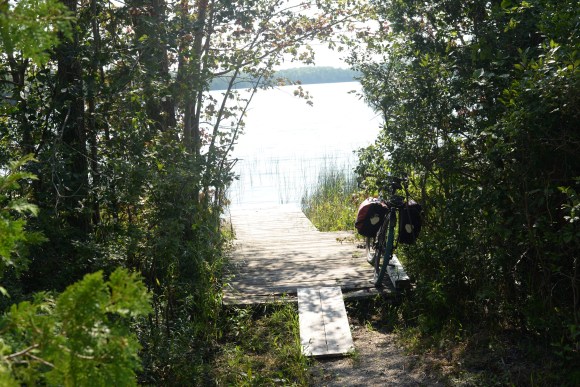
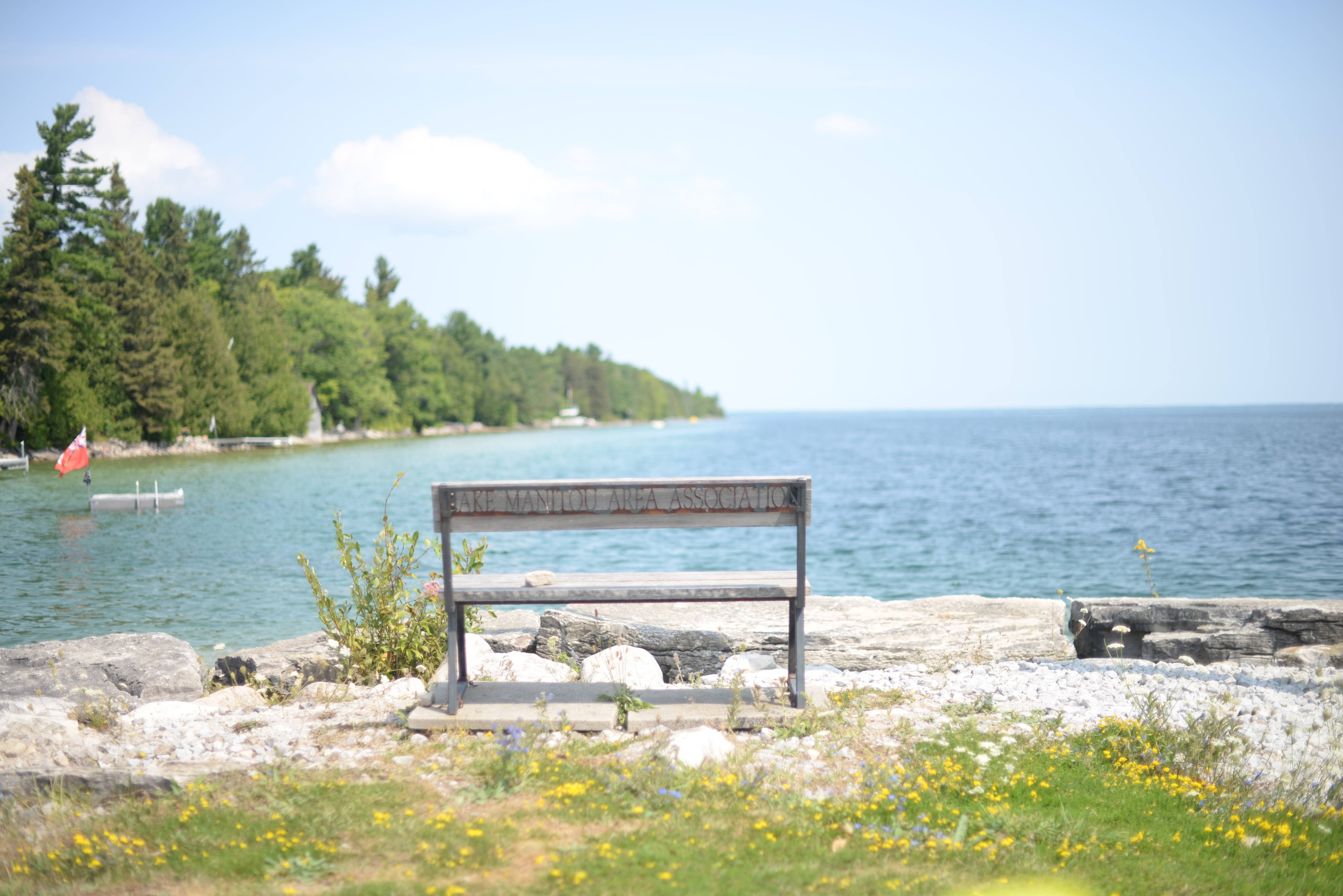
I make it to the hamlet of Sandfield which has a little dock, boat launch, as well as a general store (which is closed, good thing I already bought my food!). There are signs saying “no swimming” so I just dip my feet in the water and then sit at the sole picnic table enjoying my food. It’s a hot, sunny, summer’s day so it’s enjoyable to just sit and drink a cold pop looking at the lake. There are cottages nearby and some of the kids staying there go for a swim off the launch. They leave and later a car arrives with a lady and her grandkid. They also swim off the launch. The lady says the water’s nice and that I should swim too and I figure if it’s good enough for the locals it’s good enough for me. I jump off the dock into the water and it’s not too cold. The dock has a ladder on it so I can either climb back up or swim to the launch. I decide to swim to the launch and walk out but it’s a bit slippery from algae. Using the ladder is definitely the better option. I swim around a bit more and then go back to my picnic table to dry off and eat more junk food. Once I’m dry and bored I decide it’s about time to head back and maybe see about getting some real food.
Conveniently there’s a restaurant on the road on the way back to the campsite, I didn’t pass it on the way to the lake because of my detour to the general store, but it looked pretty good on Google so I was looking forward to eating there. When I got there I had a bit of a dilemma deciding what to eat. Something big like a grilled fish or pasta would fill me up but I was more in the mood for lighter food. I don’t know if that’s because I’d been eating heavier foods in general or because I’d just had a bunch of junk food for breakfast but I decided to go with a soup and salad. Not having had anything else there I can’t say if I made the right choice but they were both very good. It didn’t take much of arm twisting for me to order desert as well as a vegan burrito to take back for supper.
When I get back to the campgrounds I just chill for the rest of the day and turn in early. It’s a rest day so may as well get my rest in after all.
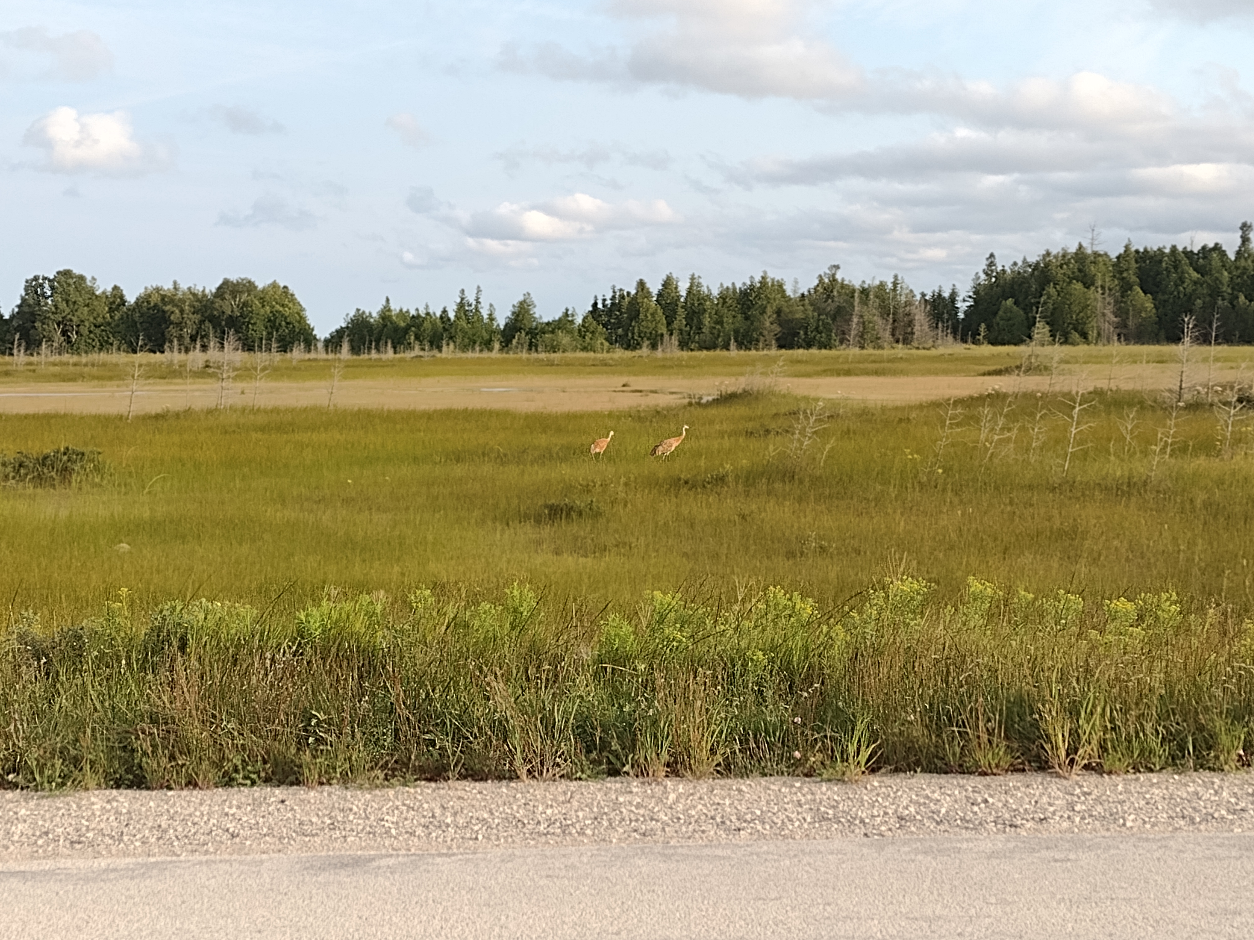
The night passed uneventfully and there was no rain in the morning so the day has already started on the right note. I use the facilities, quickly pack up and then start on my way. The first little bit of the route is on a regular road but soon I make a turn and am on a much quieter one that hugs the shore around Lake Huron. There are lots of nice views of the lake and islands that I never even knew existed. Pretty early on the road comes to a grassy, marshy area and I can see some neat looking birds in the grass. I don’t know much about birds so it’s more surprising when I can identify one. Luckily there’s someone walking their dog nearby so as I ride on my way I ask them what kind of bird it was and they tell me they’re sandhill cranes. It’s the first I’ve seen of them but won’t be the last.
The conditions are really good for riding, the roads aren’t too rough, it’s warm but not too hot, no hills, and there isn’t a headwind. I make better time than expected and hit my lunch spot early, just a bit after 10am, but I’m still able to order a sandwich. The kid working the cash register is wearing a volleyball shirt and part of me wants to say that my daughter plays volleyball too but I know my kids don’t really like talking to adults they don’t know so figure I should just keep my mouth shut. As I’m eating my lunch I can’t help but pick up on this conversation happening at the table next to me.
There are people at other tables working on laptops, presumably using wifi, so I’m not sure what they’re thinking but I had to take myself outside before I said something. I almost lose it when she tried to make an etymology of “prescription” as “before word shun” with the “shun” meaning it was something to be avoided. Nutters aside it was a lot more pleasant inside the cafe than out so I end up taking a bit of a shorter break than planned and continue on my ride.
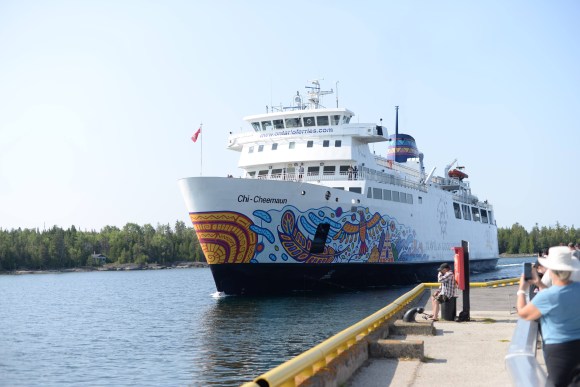
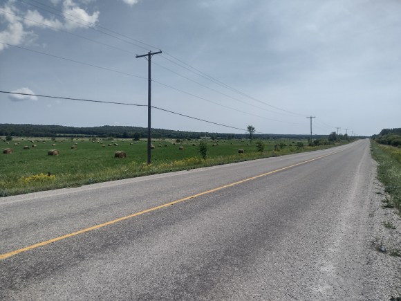
The ride is small side roads for a bit longer but then I’m on Hwy 6. It’s unavoidable at some point unfortunately. It isn’t terrible to ride on because it has a wide, clean shoulder, and it is really smooth so I can make good time on it as well. I take my first break after lunch at a little rest area and decide to check the ferry schedule again because I’ll probably get to Tobermory well before 3. That’s when I see that I misread the schedule and the only ferry before 5pm is at 1pm. Taking the 5pm ferry wouldn’t be a big deal but it would mean I’d get to the campground just before it got dark so taking an earlier ferry would mean I could be a bit more relaxed about things but I’m not sure that I can make it to Tobermory by 1pm. Only one way to find out! I push myself and make it into town, but now I need to get to the ferry terminal. I’ve taken a boat tour before so I go there but that’s not the ferry. I ask one of the employees and they point me in the right direction. Thankfully there still in the process of loading the cars so I’m able to buy a ticket and get on as pretty much the last person, they end up turning some cars away that come after me.
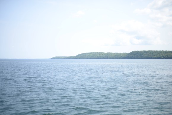
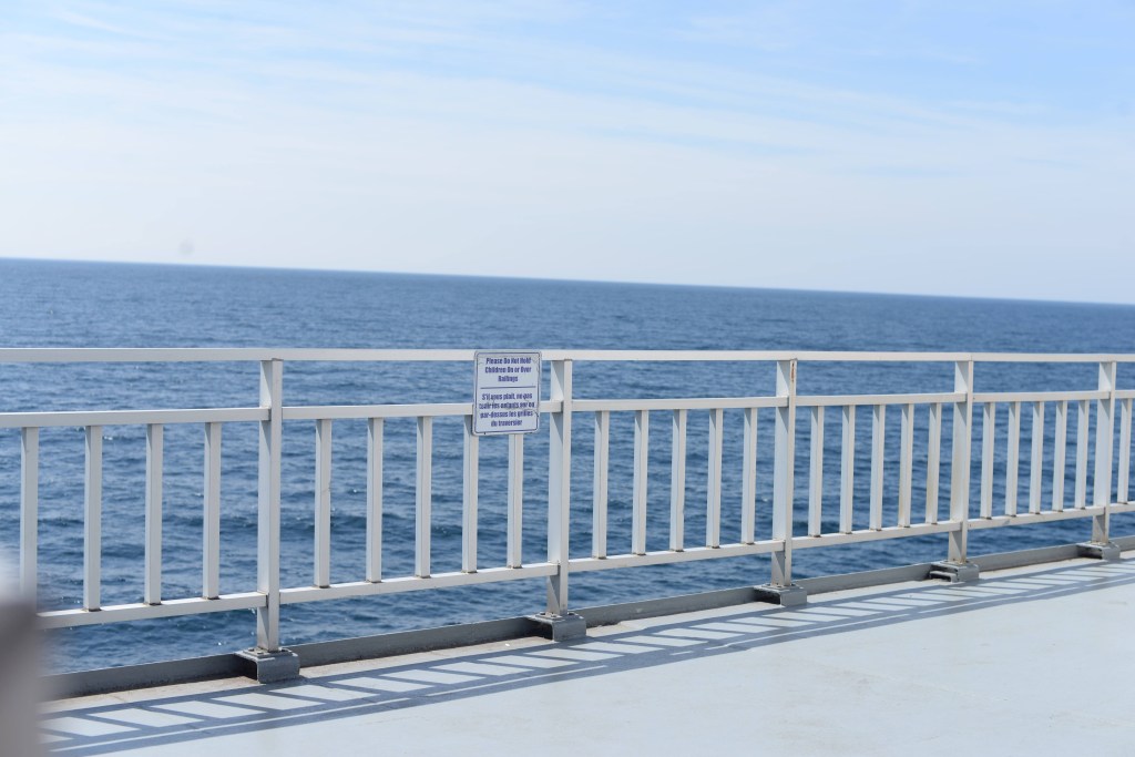
The ferry itself is pretty neat. At the bottom is the hold where all the cars are. There are even ramps for some cars to be up on a second level. As far as I can tell the cars are just left in park and are good. For my bike they had me tie it to a wall using some rope. It’s the proper kind of thick rope that you’d expect on a ship and it’s fun to practice knots tying it up. Then I go to the very top of the boat so I can get a nice view from the deck. We pull out of Tobermory fairly quickly and then make our way across the lake. It gets real windy real fast but there’s a lower deck which is also outside but protected from the wind. Without the wind and in the sun, there isn’t a cloud in the sky, it’s quite hot and I decide I’ll see if I can get some food.
There’s a proper cafeteria on the ferry and the prices are decent. I think about fish and chips again but end up getting a veggie burger, fries, and cookies. There’s pie but I’m not sure about the crust so cookies seem to be the safer option. Sitting by the window eating my second lunch it dawns on me just how big the Great Lakes are. I’m on a pretty large boat and there’s only water as far as I can see. And not only is it water but it’s fresh water. I’ve been to Lake Biwa, Japan’s biggest lake, many times and you can see from one side to the other as long as it isn’t too foggy. No chance of that happening here or on any of the other Great Lakes. Because of all this water I’d be surprised if the area doesn’t become significantly more populated over the next couple of hundred years – assuming we survive that long.
After a couple of hours the ferry arrives in South Baymouth and we disembark. It’s pretty early in the day and I need to figure out what to get for supper. I was initially thinking of getting fish and chips, which made sense when I was arriving at 7pm because they’d be reasonably warm by the time I got to eat them, but I’d need something that would be decent to eat cold. I end up making a slight detour to stop off at a market and get a veggie quesadilla.
The campgrounds I’m staying at is an “eco park”. The main attraction is that it has a dark sky preserve so hopefully I can see the Perseid meteor shower. After setting up my tent I go to the main area where the washrooms and kitchen facilities are and it turns out they have special guided events which you can participate in for an extra fee. I debate going but then decide that as I’m here I may as well go for it instead of just looking out all by myself.
The event starts a bit before sunset with the participants all gathering. There are some introductions and people talking about the eco park and meteor shower and after the sun sets they direct us to the dark sky preserve which we have to drive (or bike!) to. It’s much quicker for me to hop on my bike and go than people to walk over to their cars and get out of the parking lot so I’m one of the first people there, which isn’t great when it’s dark and the driveway to the place is windy and has branches. There are a couple of times where I end up waiting at a branch to see what the cars do but eventually I make it to the proper parking lot and lock up my bike off to the side. There’s another gathering just inside the parking lot where they mention that there generally are bears in the area but nothing around tonight, which is nice to know! Then we take a short walk to the actual viewing area. It’s a wide open field with small cabins and tents around the perimeter. You can camp here as well but you’d have to go back to the main campground for a shower or proper toilets instead of outhouses. If I had the choice I probably would have booked here but by the time I made my reservation only large sites were available and they cost a lot more. They tell some indigenous stories about various constellations which are interesting to listen to at the time but I remember nothing about them afterwards. As they’re talking we see a couple of meteors cross the sky, and whenever one is seen you’ll hear people’s exclamations. Of course by the time you hear it it’s already too late so you just have to keep your eyes peeled for the next one. They bring out a telescope and show some planets which is neat. They also mention that last night people were able to see the Northern Lights, which got everyone excited, after all who doesn’t want to see them?
Surprisingly, even though we are at pretty much the peak for the Perseids there weren’t all that many meteors going by. I guess that’s a thing with any natural phenomena, you can prepare as much as you want but at the end of the day random variables mean that it might all be for nothing. I stay until a bit after midnight hoping to see the Northern Lights but it’s getting cold and I’m pretty tired so I call it a night and ride back to my tent. Thankfully navigating the driveway on the way back isn’t a problem. I find out the next day that no one ended up being able to see the Northern Lights, so at least I didn’t miss that.
So how was my first night sleeping alone in a tent? About normal. No animals came after me, no park rangers or police woke me up and told me to move along. But also no uninterrupted 8+ hours of rest either.
A little bit of a confession here but I’ve never had a good night’s sleep while camping. Sleeping on a thin pad or air mattress isn’t as comfortable as a bed, there isn’t enough space to move around, there are noises I’m not used to, and I’ll wake up around midnight needing to go to the washroom and then spend too long trying to avoid going out of the tent. Then in the morning I’ll try to stay in my sleeping bag just a little bit longer because even though I wasn’t sleeping all night I don’t want to get out of it and into the cold. Even though I try to be lazy I still end up getting out of the tent pretty early. When you’re camping that’s a good thing because there’s always stuff to do in the morning, packing, making a fire, boiling water, etc. All my camping trips are just for 2-3 days so some sleep deprivation isn’t a big deal because it isn’t accumulating to the point where I become a zombie, and it isn’t as if I’m getting an uninterrupted 8+ hours at home either. I feel like my big issue is that I’m a side sleeper and that I usually switch sides over the course of the night. Maybe if I can train myself to sleep on my back then it’ll pay off for camping.
One hope for this trip was that by the end of the day I’d be so tired that sleep would come quickly and be deep. It didn’t happen on night 1 but there were 5 more to go!
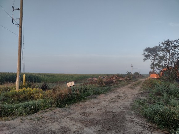
So my alarm goes off at 6 and I check the forecast. It’s raining and it doesn’t look like the rain will go away for a couple of hours so there’s no point in trying to wait it out. Thankfully I’m protected by all the tree cover but once I’m on the road I’m not going to have that so I’m going to get wet, but that’s OK because it’s warm and once the rain stops I’ll dry out fairly quickly. I hear the sound of someone approaching and open the door to my tent, I can see a horse wagon going up the road. I’d seen some Mennonite looking farmers yesterday so the wagon wasn’t too surprising to me. I start to pack my stuff so I can head out, breakfast will be at a Tim Hortons in Markdale an hour or so away. The road itself is pretty loose gravel and I’m still going downhill so I’m checking my speed as I go because I really don’t want to wipe out. After about half an hour of riding and getting soaked the rain stops and I end up near some electrical station by a river and see some signs for the race that Jason did yesterday. A bit more riding and I make my turn-off and now I’ve got to climb roughly 120 metres over a 1.2km span. Not a fun hill at any time but particularly when you’re wet and loaded with gear. But at least the climb will warm me up. On the climb I see a couple of more signs for the race so I guess they had to do some climbing as well.
I don’t love hill climbing but I don’t hate it either, I just end up in my lowest gear fairly quickly and spin my way up. I find this a better strategy than trying to power my way up and then dying half-way, or even making it up but being too drained by the effort. When my bike got rebuilt in April I had them change my rear cassette to give me a bit lower gearing overall because the only time I’d use my highest gear was pedalling down hills at 50+km/h and I’m more than happy with just gliding down them at those speeds, but this way I’d have a lower gear to help me with the hills. It definitely came in handy with this hill! After making it to the top of the hill it is just normal country roads until Markdale. As I get close to the Tim Hortons I see that Markdale has a hospital. I wonder what it must be like for the doctors and their families to live out here. The two nice things about the Tim Hortons is that the washroom is nice and clean and they have Chocolate Eclairs! I’m not sure how the donut distribution works for Tim Hortons, most stores don’t carry the eclairs but you’ll see them at random ones in the middle of nowhere. They may not be the “best” donut they have but let’s be real none of their donuts are particularly good so you may as well get a mouth full of whip cream. So after freshening up a bit and refueling I’m back on the road heading towards the rail trail. Markdale has a Chapman’s Ice Cream factory that’s right beside it. If it were a bit later in the day an ice cream would be pretty nice, but I did just have the Chocolate Eclair.
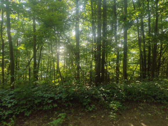
The rail trail is in pretty good condition so it’s an easy ride. There are the usual farms on the side but there are also some nice rivers and ponds as well. If Isaac were with me then we’d probably stop at them to try to catch a fish or frog, but it’s just me so I’ll take a break near one and then continue on my way.
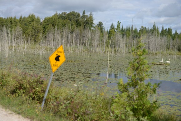
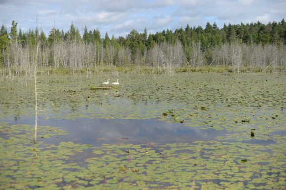
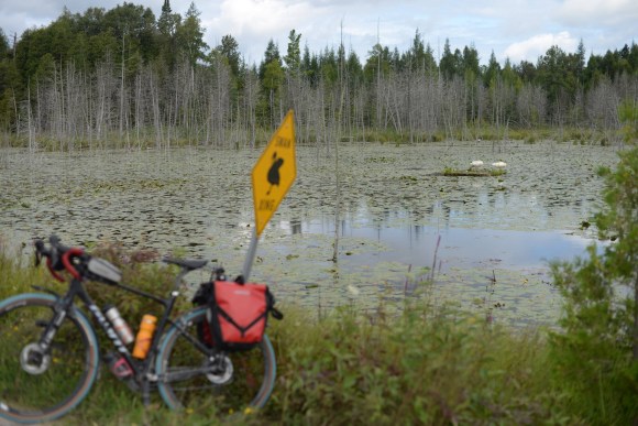
I come up to an area where the trail goes through a marsh and there’s a swan crossing sign and as luck would have it there were swans on a platform nearby. They weren’t crossing the trail but it was still neat to see that the sign was accurate. I don’t think I’d want to deal with swans actually blocking my way if I was only on my bike, I’m not sure if they’d back down!
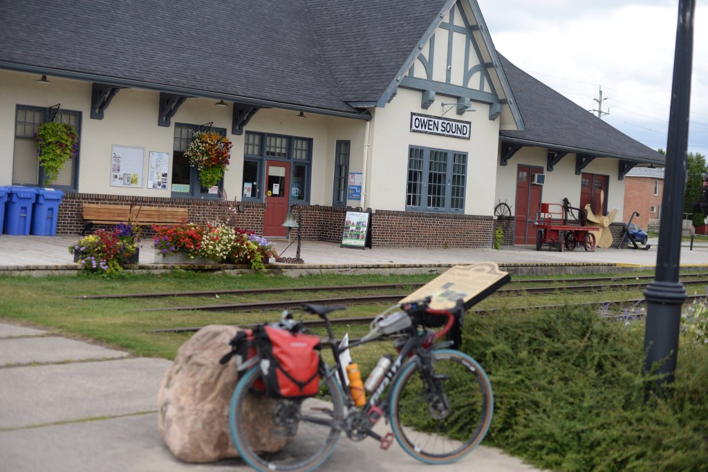
The trail takes me all the way to the edge of Owen Sound and I make my way into the city. On a Sunday morning the place looks pretty sketchy for the most part although there are a couple of streets where it looks like they’re trying to make it look nicer. As I’m riding a building looks familiar but I’m not sure why, and then I remember that some clients purchased a property here. I take a couple of selfies with it in the background to send to them later on.
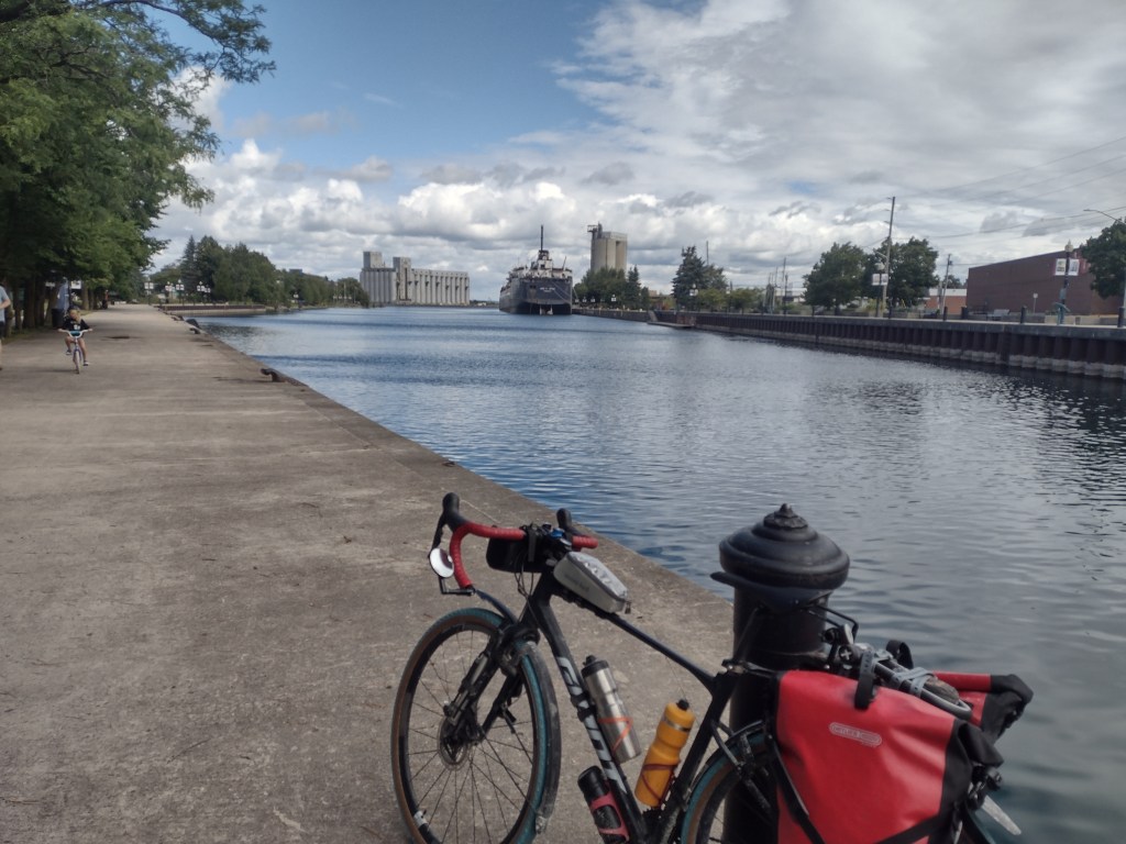
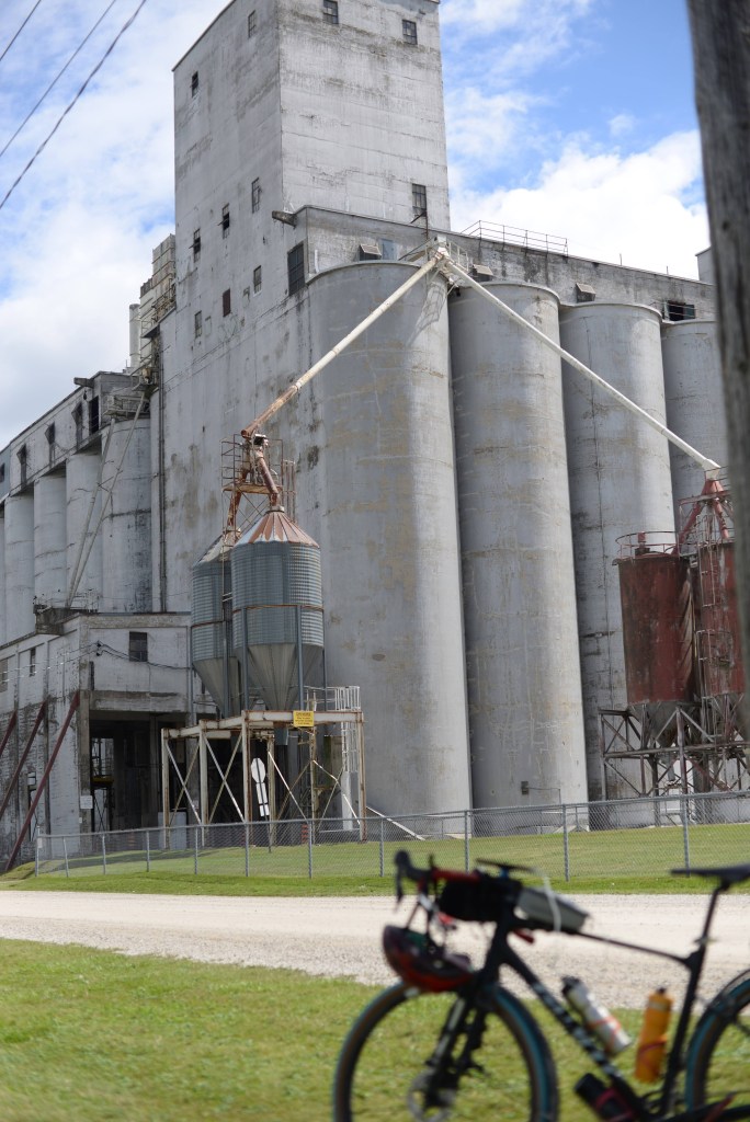
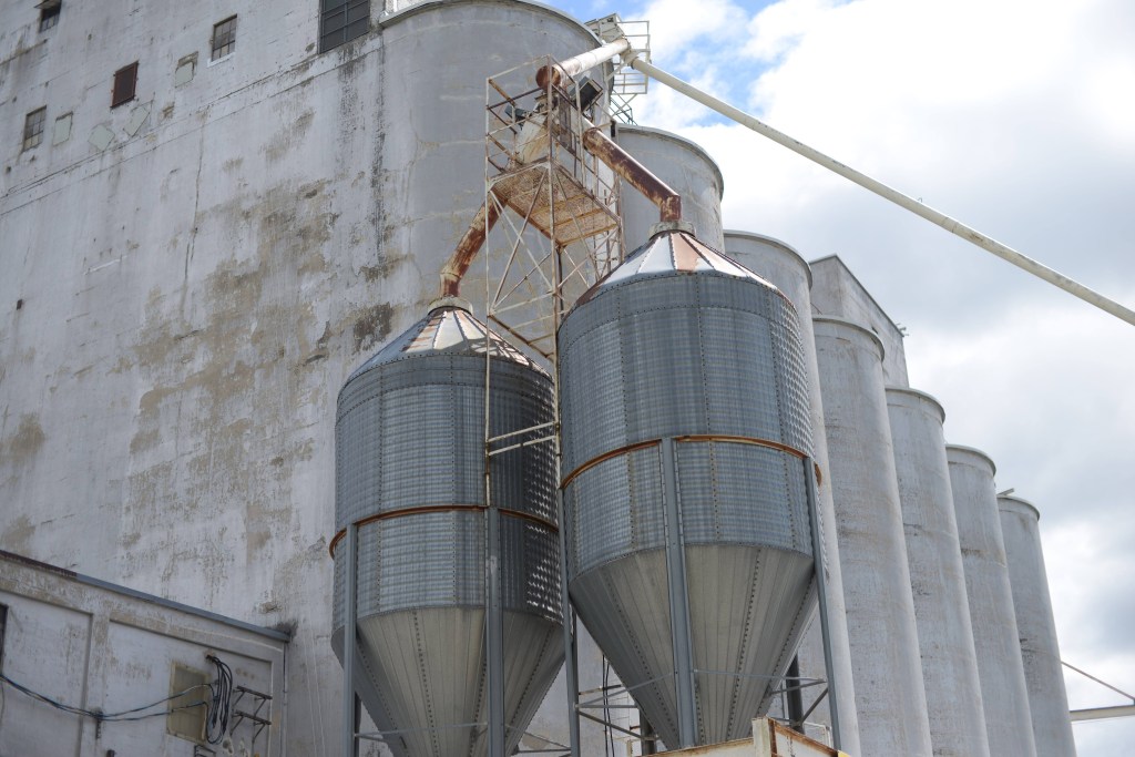
Originally my plan was to stop for lunch in Owen Sound but as I still have my pizza I’ll just eat that instead. There’s a harbour area with some benches so I take one over and enjoy my lunch. I take my shoes off to help dry them and my socks out a bit more. As I’m eating and resting I see another bikepacker come by. It’s a woman by herself so I don’t say anything even though I’m dying to ask questions about her trip. She ends up riding by and sitting down for a break on the other side of the harbour. Guess we’re not comparing notes then. Right near by there’s a tiny railway museum with a car you might be able to go inside, and towards the end of the harbour there’s a large grain elevator that looks pretty neat so I decide to give it a closer look as I kill time during my “rest” period. The grain elevator is pretty big, and I watch a racoon climb some steps and then disappear into it, I guess it makes a good home if nothing else.
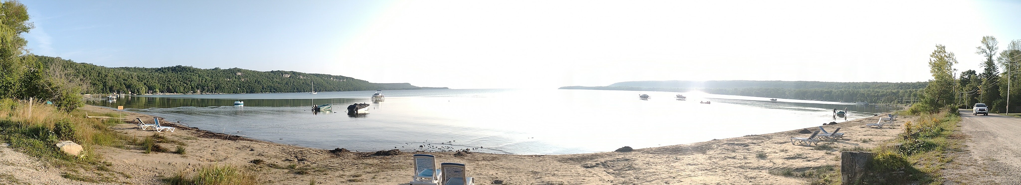
All of a sudden it starts raining even though the forecast is supposed to be clear for the rest of the day. I first quickly go to a supermarket so I can buy some sports drink to fill my bottles with and then wait under the covered part of a plaza for a while. The rain isn’t going anywhere so I figure it’s time to get wet again. After not even 5 minutes the rain gets really hard again and I take shelter in another plaza. As I’m waiting for the rain to die down another biker comes by, he had gotten some food from a nearby food truck and needed a dry place to eat. Once the rain finally did die down we both left and it ended up that we were going in the same direction, the Georgian Bluffs Rail Trail, so we started to chat. Mark lives in Sauble Beach and had rode down to Owen Sound for lunch as an excuse to go for a bike ride on a Sunday. He also works at nuclear power plants but he’s full time at Bruce. Kind of a weird coincidence that the only two people I’ve had lengthy conversations with are both involved in nuclear power. We’ll see if this keeps up. We end up riding together the whole way and talking the whole time. He’s riding at a faster pace then I’d do if I was by myself but it wasn’t too fast and as we both had the same final destination it isn’t as if I had to save my legs to travel any farther today. The trail doesn’t go the whole way to Sauble Beach so the last bit is fairly quiet paved roads. On the roads I end up riding beside him instead of ahead or behind him because I don’t like hugging the right line so that cars can drive by at speed way too close. It’s an empty road and if they need to pass they can change lanes and do so. I’ve got a mirror so if there’s oncoming traffic at the same time I’ll move out of the way but otherwise how hard is it for them to change lanes and safely pass. Mark doesn’t look particularly comfortable with me sticking myself into the road but he doesn’t say anything either. We make it to Sauble Beach and Mark invites me over to his place to wash my bike – rain plus muddy trails makes for a dirty bike and more importantly a dirty drivetrain. He offers me a post-ride beer and I tell him that I don’t drink and am good with my sports drink. I probably could hang out at his place for the rest of the day but I’m a bit anxious to set up camp and maybe take a swim while it’s still hot. Sauble Falls Provincial Park is just outside of town so it doesn’t take too long to get there. I check in and make my way to my campsite. It’s a pretty standard car camping park which isn’t great for quiet or privacy but means there are proper washrooms and showers which are amazing after a day on the bike. I set up my tent and sleeping stuff, put on my bright yellow swimming shorts, and then make my way back into town. On the way in I stop off at a grocery store and pick up some handmade cookies. They had butter tarts as well but those had lard in them. The actual beach at Sauble Beach is really long. I don’t particularly want to be around a lot of people so I stop off pretty early so that I’m still at the far end of the beach. The water is cold but it’s hot and sunny so it feels nice. A more pleasant version of the ice baths that athletes will do after intense activity. It’s also really windy so after I’m done swimming I tie my wet towel and clothes to some swings so that they can dry up quickly. Eventually people come and use the other swings so I take my stuff down and just put them on the sand.
Once things are dry enough it’s time for supper. Mark had recommended the taco truck and a restaurant that had been on a reality show but all I really wanted were some fish and chips. Google sends me to a strip mall just outside of the main drag and it looks pretty divey which is a good sign – they focus on the food not the decor. When the food comes the portions are pretty large but the quality is nothing special. The place is kind of weird because people keep coming in, talking to the elderly woman running the place, and then going into the back/kitchen. Feels like a front for something that I’ll never find out. Stomach full I head back to camp. One plan I had was to do some laundry, I even got change at the grocery store, but when I go to the laundry area I see that there’s no detergent for sale so there’s no real point. It’s still a bit too early for me to sleep so I walk down to see the actual waterfall. There’s a small path in the woods that leads down some wooden steps that brings you close to the river. I don’t know if you can actually go in the river here because it’s pretty dark. From what I can see the waterfall is pretty nice, although not particularly big, this isn’t Niagara Falls by any stretch. There’s only so much time to be killed looking at an unlit waterfall at night so I make my way back to my camp site so I can sleep. One nice thing about sleeping in the forest last night was that I was all alone. Here I’m by myself but I’m surrounded by people in groups having their dinner, sitting by camp fires, and otherwise being social with each other. It would be nice to sit by the fire with someone and go over the day and plans for tomorrow. Maybe next trip.
With all the preliminaries out of the way the only thing left to do is actually start riding my bike!
Sadly this only lasted the 10 minutes or so it took me to get to York Mills Station, then I had to find the GO bus bay and wait for my bus. I showed up early because the buses have a limit of 2 bikes and I didn’t want to be in a situation where I had to wait for the next bus. The bus came, there were no other bikes, so I was able to get on and head to Brampton. Once I got off at Bramalea GO station it took me a while to figure out where I was supposed to go. My watch could only tell me where it wanted me to be with a light blue starting flag on a black screen but it doesn’t show a map of the area so it was tough to see how to get there. Eventually I opened up my route on my phone and things started to make a bit more sense. I’d need to go under the train tracks to the far platform and make my way to a parking lot from there. After that it was relatively straightforward, I took some industrial streets until they finally ended at the Etobicoke Creek Trail. The trail was nice as it was fairly green and kept me off busy streets for the most part, although there were a couple of sections where I had to go through residential streets due to golf courses or construction. On one such detour I was waiting at a light when someone else on a bike joined me. He saw my getup and asked where I was heading. He then explained how to get back to the trail (he wasn’t using it as he would be taking a more direct route to his destination). The trail is quite long but it was always tying into different parks. It reminded me a bit of the Humber River trail. I followed it to its end at Kennedy Road near some subdivisions at what looked like the end of Brampton, and sure enough once I was clear of this last group of houses I was between farmers’ fields. Things started flat but I knew that there would be some big hills as I got closer to Caledon.
Near Inglewood the road crossed the Caledon Rail Trail. I hadn’t biked on this section of the trail before but I did walk on it from the nearby Ken Whillans Conservation Area. At that time we had stopped for ice cream but it was too early for me to get an ice cream now. There was also a bicycle shop that had a cafe. It was tempting to stop and check it out, but again it felt a bit too early in the day for that. BUT, it’s probably worth checking out on a family outing along the rail trail.
Eventually I made it to Orangeville. The plan was to have lunch and then hang out for an hour or so to give myself time to fully digest it. I’ve noticed from other rides that I feel noticeably worse riding after a meal. I can’t skip the food on a long trip so need some other way to deal with it, and giving myself a long break so that hopefully my blood would leave my stomach and come back to my legs seemed like the best plan. I ended up getting fish and chips from a place outside of downtown. They were a bit put off by my request to bring my bike inside but they were fairly empty so it wasn’t in anyone’s way. After lunch I went back to downtown Orangeville. They had a farmer’s market as well as some event where live musicians were playing on different street corners. I spent most of my time playing Pokemon Go and trying to do a raid, but no one else joined in. I decided I wanted to get some ice cream as well. Years back I had stopped at Orangeville on the way back from a camping trip and we were able to get ice cream from some place that gave huge scoops for very low prices. Sadly they weren’t open anymore so I had to find somewhere else. There were signs pointing the way to a Mill Creek Gardens ice cream shop so I followed them until I got to the store. I asked if they made milkshakes and when they said yes I ordered a vanilla. They didn’t have prices listed but how much could a milkshake be? $10 apparently. The milkshake was pretty average too so I couldn’t tell myself that at least it was a really good one and was worth it that way. Anyways, with my milkshake I went back to the main street to finish my resting period.
Rest done it was time to continue, from Orangeville I’d be taking the rail trail for the rest of the day, so I wouldn’t need to worry about hills anymore. There was some construction going on in town so I had to ride on gravel roads for a couple of km until I could join up with the trail.
Out past Shelburne it started to rain, which wasn’t on the forecast. I rode for a bit hoping it would pass but as it got stronger I realized I had to put my jacket on. Thankfully the rain didn’t last for too long but I was already wet and it wasn’t particularly hot or sunny anymore either. As I made it to Dundalk I decided that now would be a good time for a hot drink. There was a cafe right by the trail, they wouldn’t let me bring my bike inside so I locked it up by a window and then took a seat by the same window so that I’d be able to keep an eye on it. I stayed just long enough to have my coffee and dry up a bit and then continued on my way to Flesherton.
When I got there I was still a bit early to set up camp so I thought I’d scout out the area first and then come back to get supper. But as I was going to the site I discovered I’d have to take a pretty steep downhill, which would mean coming back up that same uphill which I really didn’t want to do. So I rode back into town to get my supper. I saw some signs for something called the “Flesherton Fling” that was happening that day but I didn’t see anything happening anywhere. Maybe I missed it?
At the pizza place they had slices but all of them had some kind of pork on them so I ordered a whole pizza instead. I was feeling pretty hungry so I figured I’d be able to eat a small pizza without issue. The pizza would take a while so I asked if I could plug in to an outlet to charge my devices and then went to the washroom. When I came back someone else came to make and order and while they were waiting for their pizza to come we got to talking. I guess when you pull up to a place and see a loaded up bicycle and then when you get in and see someone in biking gear it’s pretty obvious they’re on a trip and it’s a pretty easy conversation starter. I told him about the ride so far as well as where I was planning on going. I think his name was Jason and he had just run a marathon on the Bruce Trail and was going to run a half-marathon the next day as well! I fell like of the two of us he was going to have the tougher weekend. He works at nuclear power plants, sometimes at Bruce Power in Kincardine and sometimes at the Pickering power plant. When he’s at Pickering he would often go to the Durham forest to run after work. He really loves running! Once his pizza was ready he left to go back to his hotel to get ready for the run the next morning. I kept on eating my pizza but after a while I had to accept that even though I was hungry I wouldn’t be able to finish it so I asked for some paper plates so that I could pack the remaining slices better. Maybe it would be my breakfast tomorrow. Now I had to make my way to where I’d be camping and it really was a big downhill. It was fun to ride down at the end of a long day but one saying I like to say when I’m riding with Haroon is “what goes down must go up” it’s an inversion of the more popular saying but for biking it fits my pessimism about hills pretty well. I’d be saying this to myself a lot over the course of this trip.
At Hoggs Falls I tried to look for a good place to camp. I wanted to be hidden from view because even though the GMBR map said this was Crown land I couldn’t find anything about it on the policy atlas and didn’t want to be woken up in the middle of the night by some ranger or property owner telling me to be on my way. I was able to set up camp down a small hill off the side of the road and hoped I wouldn’t be visible to any passers by.
I was a bit worried about keeping my pizza with me in the tent but it was in my waterproof pannier so hopefully not so much smell would get out. Also, it being summer there were lots of other food sources around so hopefully no creature would be foolish enough to interact with a person when they could just get something else instead. I guess we’d find out soon enough.
Bikepacking is like a combination between riding a bike and hiking/backpacking. As a year-long commuter I’ve been riding my bike for a while and have lots of equipment to deal with various weather conditions, carry stuff, and perform repairs. Similarly, as someone that goes on a couple of hiking trips every year I’ve got all the needed gear for that as well. Because this trip is a bit of a test run I wanted to buy as little new stuff as possible and make do with what I already had. Then after using my existing gear on the trip I could see what the actual pain points were and then make purchases accordingly. I figured this would be better than just buying a bunch of stuff and then finding out later that they didn’t offer any benefit over what I already had.
This is the part where you normally see pictures of a bike along with all the gear the person plans on using on their trip, maybe with a link to LighterPack or something similar. I think there are a lot of factors at play when people post these gear lists and pictures ahead of time. The first one is a bit of fear of the unknown, people are afraid they’ve forgotten something important or haven’t considered some risk. By putting your list out there and getting comments about it ahead of time someone can come and say “hey, you should bring X with you because that’s saved me a couple of times” or you could get comments that confirm that what you’ve packed is comprehensive enough and you’ll be fine. There’s a backpacking adage “don’t pack your fears” which I try to be mindful of, take what you think you’ll need but don’t start inventing scenarios that need you to bring extra things. The second one is excitement about the coming trip. It’s fun to plan about what you’ll need on your trip and these lists and pictures are a way to share that excitement ahead of the trip and also to get people more excited about the trip they’ll be taking. Let’s face it the first part of a lot of trips is getting away from “civilization” and it can be hard to feel like you’re going on an adventure as you’re riding through subdivisions and exurbs for a couple of hours. The third one is the consumerism that is the air we breathe on the internet. We’re bombarded by ads to buy things and then there’s sponsored content or influencers that promote things in a more “organic” manner. During races like the Great Divide bikepacking.com will put out posts about the rigs and gear various participants use. Sure it’s just a survey of what people are using but it is also a way to highlight various bike and gear companies, many of whom are advertisers and sponsors of the site already. Sometimes I’ll wonder if someone all kitted out from one brand has worked out some kind of sponsorship deal with them and their post is them working on their end of the deal. I didn’t take any pictures of my stuff, just feels weird to me to take pictures of outdoor gear at home not being used. On my biking trip in high school I really didn’t have any good equipment and made it just fine so while I get that having better gear could make the trip better I wasn’t particularly worried that I’d have problems if I made do with what I had, especially as what I had was already pretty good.
So here’s all my stuff.
Stuff already attached to my bike
Rear rack. When I bought my bike I asked them to put in a rack and this is what they put on. I know from years of experience that the rack can handle quite a lot of weight without issue so I’m not worried about anything happening to it.
Woho seat bag stabilizer. I don’t have a seat bag but like the idea of being able to attach a water bottle cage to it if I end up putting a frame pack in the main triangle. Presently I have my rear light on it because it is more visible there than on my seatpost.
3 bottle cages. One on the seat tube, one on the top of the down tube, and one on the bottom of the down tube. I use the two in the main triangle for water bottles and the one at the bottom holds my everyday tire trouble kit. Even though they’re all red metal cages they’re all a bit different from each other. When I bought the 3rd one I thought it would be the same as my 2nd one but it didn’t turn out that way. It isn’t something one would notice as I’m riding by but if you look close enough you’ll notice it.
Everyday tire trouble kit, this is a small cylindrical bag that fits in a bottle cage. In mine I’ve got a 2oz bottle of sealant, some tire patches (not tube patches, but tire patches), tire levers, chain pliers, quick links, a schrader to presta adapter, tubeless tire reamer, and plugs/bacon strips. On my commute if I get any tire trouble that can’t be solved by pumping more air into my tire I’ll just take the bus and deal with the repairs at home, but if I’m going on a fun ride somewhere without public transit I like knowing that I’ll be able to take care of a lot of minor issues.
Mirror on my left handlebar.
Bell on my right handlebar.
Quad Lock phone mount on my stem.
Bicycle pump on my front fork.
Front light on my front fork.
Front and rear SKS Speedrocker fenders.
This is all stuff that is with me every day. When I do the P2A (Paris to Ancaster) race or other rides where it will be really muddy I’ll remove the rack and fenders. They’re great with water and small amounts of mud but at a certain point they just become more things for the mud to get stuck in and become more trouble than anything else. I expect to be a mess by the end of those rides anyway.
Bike bags I already have
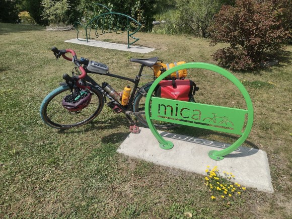
Pair of Ortlieb Backroller panniers. This is the 3rd set of panniers I own. The first two were more affordable MEC branded ones that fell apart after a couple of years use. After the second set died I decided I’d just bite the bullet and get the Ortliebs because by all accounts they are bombproof. After almost 4 years of daily use I’ll agree that they are in fact bombproof. The panniers are quite large and I planned on carrying almost everything in here.
Mont-Bell top tube bag. This is a small bag my in-laws sent me for my birthday. I’ll generally put a spare battery, wallet, and snacks in this if I’m going on a long ride. I don’t bother with it when I’m commuting and will just put stuff in the panniers instead.
Small handlebar bag. I use this mainly when I’m doing races as it holds more snacks than the top tube bag.
Camping gear I already have
1 person Naturehike tent. This is kind of cheating because I bought this a year ago in the hopes of going on a bikepacking trip. I’ve used it a couple of times on hiking trips so I know it works, even in bad weather.
Inflatable sleeping pad. I was planning on taking my closed-cell foam one as that is pretty indestructible BUT it is also too big and bulky, even just being strapped to my rack, so the inflatable pad it is.
Inflatable camping pillow. I used to make do with putting my clothes in a dry bag and using that as a pillow. Brian got me this for my birthday one year and it takes next to no space so I’ve been using it since.
Swiss Army Knife.
Camping knife – this thing is super sharp.
Other things I’d be taking
First Aid kit. I don’t know how to use most of the things in it but hey if I get into trouble and someone finds me maybe they’ll know how to use it to fix me up.
Bike tools – 2 different multi tools and an adjustable pliers. Between this and the stuff in my everyday kit it’s pretty much everything I use at home for my bike. Anything more than this wouldn’t be of much use to me because I probably wouldn’t know what to do with it.
Spare tube. My tires are tubeless but I always take a spare tube on longer rides in case I get a cut that won’t seal. This way I can patch the tire, put in a tube and continue on my ride.
Hydration backpack. 2 water bottles isn’t enough for me, I’ve had situations in the past where I’ve run out of water a fair bit away from my destination and had to tough it out the rest of the way. Not fun. My pack can hold 3L of water so normally I’ll fill that with water and my bottles with sports drink. With 4.5L on me it is highly unlikely I’ll run out of water before making it somewhere I can refill. One other advantage of the hydration pack is that I find it much easier to take sips from its straw than reaching down to get a bottle so I’m more likely to regularly drink water. The pack has space to carry things in it as well, such as my camera and spare tube.
Packable bags, for carrying groceries. Also, GO won’t let you have stuff attached to a bike when it’s on the bus’ bike carrier so I can take the small bags off and put them in these.
Bike lock. Because I’d be stopping off at stores and my bike would be out of my sight I brought my lock with me. It is big and heavy but very angle grinder resistant so hopefully no one would be able to steal my bike while I was getting food.
Two stainless steel water bottles. I probably wouldn’t be cleaning these out very well each day so there’s lots of opportunity for mold to grow in the water bottles. As these are stainless steel with silicone there isn’t a good surface for them to grow on.
Clothes
2 jerseys
1 cargo bib, 1 bib short
1 MTB shorts to go over bibs
1 cycling pants
1 thin full sleeve shirt
1 full sleeve cycling base layer for sleeping in
1 pajama pants
1 swimming shorts
3 pairs socks
1 pair sandals
1 packable rain jacket
2 pairs cycling gloves
2 headbands
2 pairs cooling arm sleeves
Electonics
Phone
Activity watch with GPS navigation
4 port USB wall plug
USB Battery
Charging cables for phone, watch, and lights
Camera
What I still had to get
The big thing I was missing is a sleeping bag. I have one bag rated to -7C and one rated to 0C but nothing appropriate for summer camping where the overnight low is only 15C. I’ve never invested in a good summer bag because my summer camping is usually car camping so taking the extra weight and bulk of a winter bag isn’t much of a problem. Even for bikepacking weight-wise they’d be OK but they just take up too much space. I think long term I’m going to try my hand at making a simple quilt out of Primaloft or some similar fabric. But for this trip given the warm weather I ended up buying a sleeping bag liner and figured that between that and my clothes I’d be warm enough overnight. I’d be able to use the liner to give myself an extra couple of degrees of warmth for my fall and winter trips as well.
The stuff sack that my tent came with is just about a perfect fit, which means that it takes a lot of careful folding and rolling to fit it in. I don’t want to spend that much time every morning putting my tent away so I needed to get a compression sack I could just put the tent in and then squeeze to take up less space.
I was planning on taking my camera and putting that in my hydration backpack. I’ve done it before for a race and it works OK. I don’t quite trust the bladder in the pack not to leak so I put my camera in a dry-bag before going in the hydration pack. The only thing is that in order to fit the camera the dry-bag ends up being way bigger than needed so there’s less space to put other things in the backpack. Sadly none of the dry bags that could fit the camera were any smaller. I ended up getting a waterproof toiletry bag that could barely hold the camera.
Tomoko took my camping towel with her to Japan so I needed to get a replacement. Also a small bag to put my toiletries in.
A good thing about bikepacking as opposed to hiking is that it is hard not to be near shops or restaurants over the course of the day. So I could take a stove, cookware, and dehydrated food but I could also just buy stuff along the way and not have to deal with the added bulk and weight of carrying food-related gear all the time. If I was going somewhere more remote like Northern Ontario it would likely be a different story but the Bruce Peninsula is dotted with small towns although there would be some days where I’d need to buy food and keep it for my next meal as there would be nothing nearby at that time.
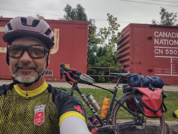
My handlebar bag would hold my snacks (granola bars). The top tube bag carried the battery and charging cables as well as a packable bag. My sandals and lock when on the top of my rack and everything else fit nicely in the panniers and the bike still handled fine. Nowhere near as easy to pick up though.
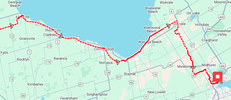
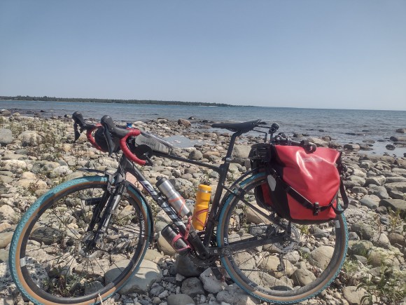
Here’s me with the bike so you can see how it all looks:
With a general plan in place I then had to work out some of the additional details, the most important one being where would I be sleeping every night. I’m fine with camping anywhere but do need to know where I’d be sleeping for a given night. Also, the plan was to spend my time on Manitoulin Island at a campgrounds with a dark sky preserve. They had campsites available on the 2nd and 3rd nights but the fee for the sites was something like $130 per night because they were bigger sites that could accommodate more people. However if I reserved for the 3rd and 4th nights then it was a more normal $50-something. As an aside it is kind of mind blowing that it costs $50 to get a campsite now. I guess reservation fees just go up every year and this is where it ends up. So I decided I’d change the plan to take 3 days to make it up to Manitoulin Island, have the 1 rest day there, and then 3 days to come back down. The rest day there was mandatory because the campground on Manitoulin Island had a minimum 2-night stay policy during the peak of the Perseid meteor shower. Now I needed to plot out my other days so that I could book campgrounds, or find Crown land to camp on, for the other nights.
The GNBR maps have annotations for places to stay including campgrounds, private listings, people willing to offer space to camp for free, and spaces suitable for stealth camping. The idea of stealth camping is neat but my worry would always be someone waking me in the middle of the night telling me to leave, so I’d only do that as a last resort. In my initial plan to get to Manitoulin Island in 2 days I was going to camp overnight in Owen Sound. Now that I had the extra day it made sense to find somewhere a bit further up the Bruce Peninsula and I decided that somewhere around Sauble Beach would be nice because then I could swim and hang out at the beach as well. Thankfully Sauble Falls Provincial Park had a site available for the day I wanted so that was easy. For my first night I’d need something between Orangeville and Owen Sound and there wasn’t a whole lot there, but on the GNBR maps there was a note that Crown land camping was available by Hoggs Falls which would be a good place to stop as it would take me to around 130km for the day.
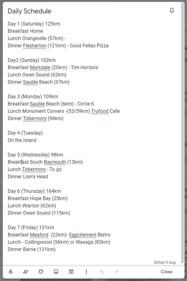
For the way back I knew that the last train from Barrie to Toronto left at 9:10 pm but there was also a bus that left at 11:00pm so there was no worry about getting to Barrie too late and being stuck there for the night. I ended up deciding to stay at a city campground in Lion’s Head for night 5 and then a private campground between Owen Sound and Meaford for night 6. With my start and end points for the days all worked out now I needed to fill in details for where I’d be getting my meals. In bigger places like Owen Sound or Tobermory there would be many available options but in smaller towns there may only be one or two, and sometimes I wouldn’t be near one when I wanted to have lunch for example, so using the route and Google Maps I then made a schedule with my distance for the day and where I’d be getting all my meals:
It isn’t the most detailed schedule but it gives an idea of how long my day will be and where I’ll be stopping for food. I planned on keeping snacks with me so that it wouldn’t be a big issue if a meal was a bit later than scheduled and for water I’d have 3L in my hydration pack and 1.5L in my bottles which would be more than enough to get me to my next meal.
So with the route and dates all finalized the last thing to make sure was that I had all the stuff I’d need for my trip.